New Zealand Trip, December 2002 (part 1: Diving, kayaking and glaciers)
|
Sarah's short photo album started this section. I then popped up most of the photos and just recently added the text. Please note, there are lots more photos (links throughout and at the bottom of the pages) and clicking on any one of the pictures should show a larger version. Part 2 (Queenstown and Milford Sound) | ||||
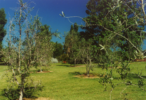
| David ran out of superlatives early in our trip to New Zealand; English needs more words for lovely, beautiful and fantastic. Our first night in New Zealand was spent in Parua House Bed and Breakfast (the red roofed building): 70 acres, 14 head of cattle and a garden that won't quit, with olives (for dinner) and fresh fruit from the garden to accompany the fresh milk. Met the press director for the Swiss America's Cup sailing team (and his wife and young son who've been year a year from Geneva). This after Sarah checked seat availability on the flight from LA to Auckland and switched us to a later flight which was almost empty -- full rows for everyone so we were able to stretch out and only arrived an hour later. |
(See part 1 additional photos for more pictures.) |
|||
|
| |||
|
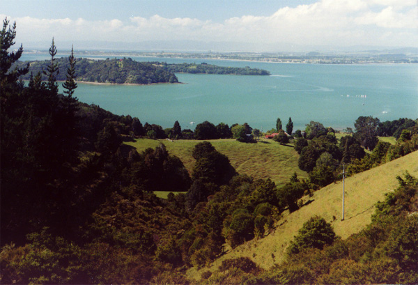
The drive up to Whangarei after landing in Auckland was truly awesome; we stopped at a small park (Goat Island) and watched the school kids on a field trip snorkeling between the shore and the island. | |||
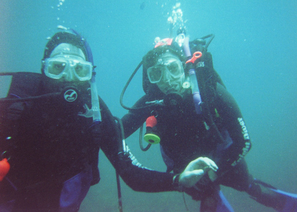
| Diving at Poor Knights Island with Knight Diver Tours was cold but lovely. The trip out was a bit rough with 3 and the occasional 4 meter swell. Day one, Sarah and me, two others, two divemasters and the captain. Day two Sarah and me, one other customer, same crew and Shane and his class of advanced Open Waster Divers. Most cool was the very large cave with the air pocket on dive one day two -- 7 meters underwater and no regulator needed in the air pocket. Knight Diver boat 36' by 16' twin hull. Poor Knights named by Capt. Cook after Poor Knights Stew: stew with dumplings when you are low on food, Capt. Cook was low on food when they passed by. |
(See part 2 additional photos for more pictures.) | |||
(See part 3 additional photos for more pictures.) |
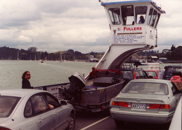
The next day we drove North up the coast to Pahia and Bay of Island which were too touristy. | |||
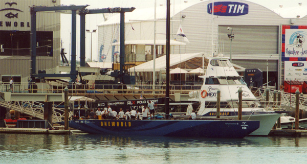
| Then we drove to Rotorua via America's Cup Village in Auckland Harbor which we wandered around a bit in, looking at the current boats getting ready and heading out and the old America's Cup boats, which tour the bay. The drive was lovely with great weather until we got pretty close to Rotorua when it rained. Did laundry in the Rydges guest laundry and spent the next day with a relaxing walk down to the lake, had our dive photos developed and a bit of brunch. |
| |||
|
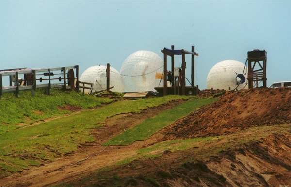
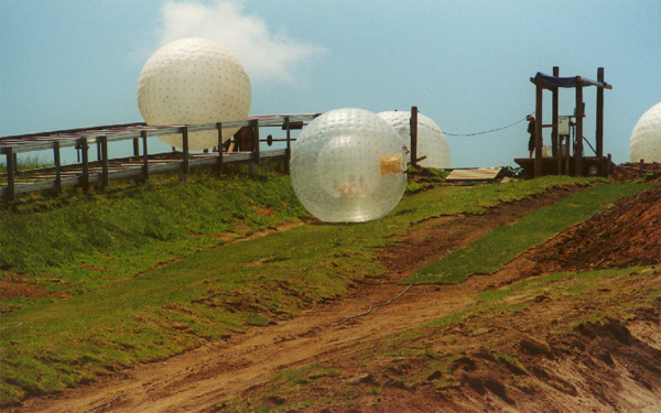
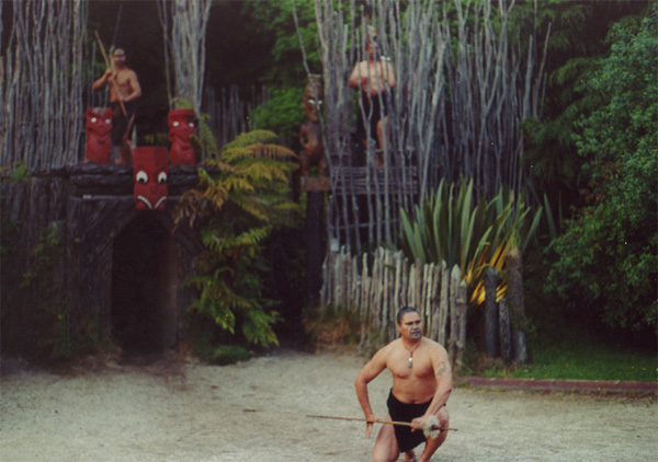
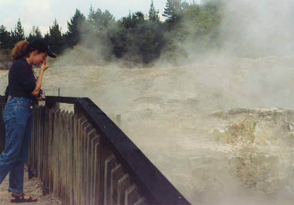
Then off to the Agrodome and a bizarre experience, Zorbing: climb into a huge inflated ball with a bucket of water and roll down the hill -- a New Zealand original and truly odd thing. Followed by a trip up in the Gondola and a couple runs of street luge on the hill. Capped off by the Maori Concert and Hangi. And our driver serenaded us with Silent Night in Maori on the way the home. Rotorua is a stinky town with all the hot springs around; one of which we visited on our way to the airport the next day. | |||
|
| |||
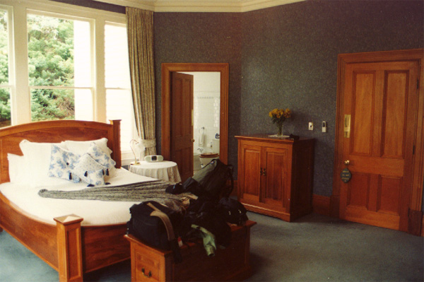
| After Hell's Gate hot springs, we dropped off the car at the Rotorua airport -- no fees for one way rentals (our Parua House host was distressed to learn of those on a visit to the states) -- and flew to Christchurch were we stayed at the very lovely Charlotte Jane, built as a girls school in the late-1800s it was very lovingly restored in the late 90's and is now a fantastic Bed and Breakfast with the kinds of rooms which star in period movies. |
| |||
(See part 4 additional photos for more pictures.) |
The next day, after a great breakfast, we went by the Canterbury Museum and happened to stumble on to Badden Norris giving a tour of the Antarctic exhibit which he helped design and collect items for (from his trips there and those of his friends and family). He wasn't able to say who (but hinted it was himself) who was stationed at a penguin rookery the Americans liked to take VIPs to -- it turns out those visits were disturbing the rookery and the population was dropping quickly. He got to keep the tourists from disturbing the penguins and saw the population rebound as an effect. Many other interesting stories - the tractor which got less than 1 mile per gallon. It would have been a boon had it not used most of it towing capacity to tow its own fuel; the primus stove that made the exploration possible (and which was recovered from the exhibit touring the US after it's visit there was extended). | |||
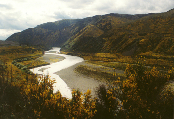
| The following day, we drove to Muchison -- a splendid drive up into the Southern Alps. Just before starting up, we stopped at Canterbury Vineyards and cafe for a lovely lunch, complete with a small sample of 8 of their vintages. As we made our way up into the mountains, our jaws kept dropping at just how beautiful it was. New Zealand's mountains are growing about 20mm a year, that's why the look so young, rugged and steep. |
| |||
|
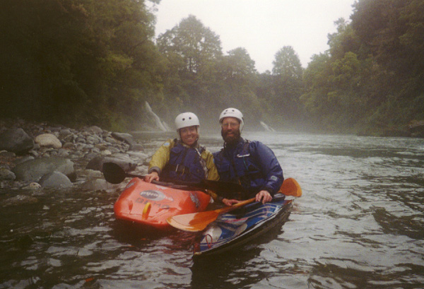
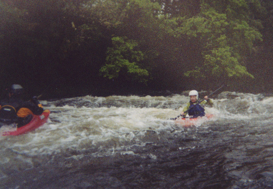
When we got into Muchison, we checked in at the Coch-y-Bandhu Bed and Breakfast, where we had the detached cottage, and got directions to the New Zealand Kayak school. When showed up, the students there said the staff were all off at the Commercial Hotel getting a bit of dinner; they said we should just wonder down there and look for the folks who looked like kayakers. That was pretty easy and we were introduced to Dave Ritchie, to be our guide for the next couple days on the rivers around Muchison. I had no clue how much great and beautiful kayaking was just outside of town. Sarah and I did the Upper and Middle Mitakitaki on the first day (after a bit of work in the pool to prove we could roll and that I had a clue, because Dave was lending me his squirt boat for the day. The whitewater was fun, easy and fantastically pretty (even in the rain). The next day we did the Mangles, popped into town for a hot lunch then Dave and I did the Earthquake section of the Matakitaki -- a real blast of a run, short but very nice, continuous bolder gardens with some nice big waves at the end. | |||
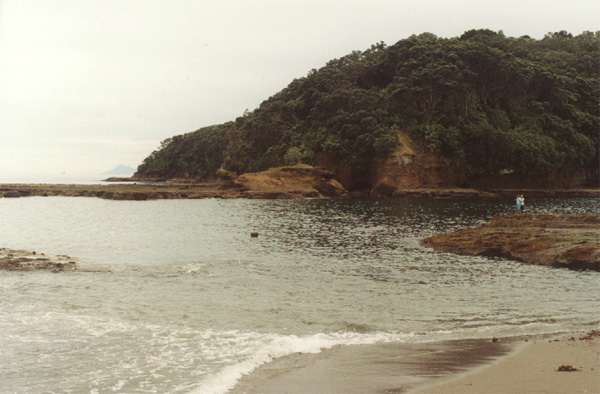
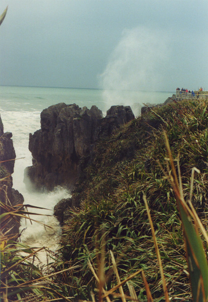
| After two days of kayaking, we drove to the west coast and south to Franz Josef. The drive started in the rain, but as we got over the western range, that cleared and it was a lovely afternoon on the coast. There looked to be a storm out to sea which I expected to see coming ashore at any moment, but it seemed to travel up the coast just off shore. On the way south we stopped for a snack at the Pancake rocks and blowholes. We happened to time it perfectly -- the signs said it was most impressive at high tide with Southerly swells. We had both as we walked along the trail to the blowholes. They were very impressive; the large waves shot well over everyone's heads (note the people at the overlook on the right side) even though the waterline was over 30 feet below us. The western coast is beautiful and rugged and the storm enhanced seas just made it more impressive. It seemed clear why few settlers approached from the west side -- we saw almost no calm bays, in stark contrast to the East Coast. David realized that he'd never seen sunlight so late on his birthday before: sunset was about 9:30pm in New Zealand's summer, rather than 4:30pm in the Mid Atlantic's winter. |
(See part 5 additional photos for more pictures.) | |||
|
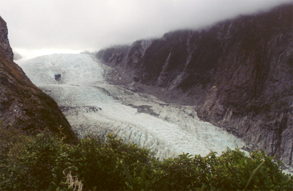
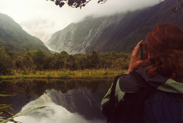
Franz Josef glacier was an impressive site. We just saw a bit of the snow cap when we arrived but the next day we loaded up our packs, put on our boots and went "tramping." First we went up the short overlook trail to see the glacier from the bottom. It was hard to get a sense of scale, but watching the occasional helicopter land helped. Then we took the Roberts Point trail up the side to an overlook above the terminal of the glacier. The tail (which the guide suggested required "good boots" started well for the first little bit (going to Peter's Pool and the first swing bridge. After that, it got a bit less nice and turned into more of a damp creek bed in many places than the nice, two abreast trail it started out as. After a snack stop at a pretty spot, a couple rest breaks and several photo breaks, we got to Roberts point about 4 hours after we started. (The signs said it was a 5 hour round trip -- that seems optimistic to me, maybe without any stops, but what's the point?) The weather held off nicely for most all of the hike, though it did rain lightly on us at the point -- which was a great view, though, again, scale was hard to judge. The hike back down over wetter and slicker rocks, was a bit quicker, but no better for the knees. We ate and slept quite well that night. | |||
| The next day we drove down to Queenstown (after trying to get an idea of the length of the trail from the Dept. of Conservation visitor center; where they said it was 2.6Km each way -- flying in the face of the maps the passed out and hanging on the wall; I don't know if the 700m elevation change was a questionable -- the hike was more like 5Km each way, I think). Another rainy start to the day, but it cleared as we headed south and inland. Still more beautiful vistas. |
| |||
|
||||